France Photogrammetry Software Market Overview
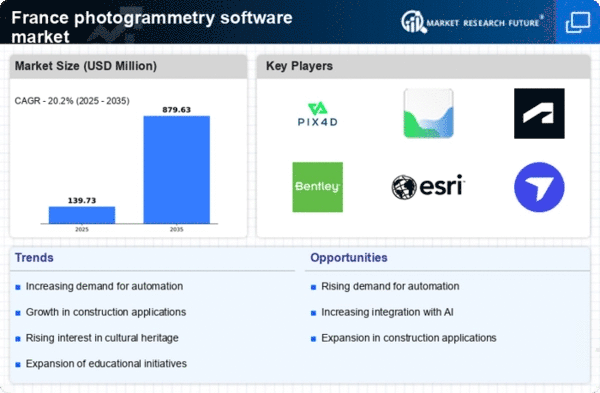
As per MRFR analysis, the France Photogrammetry Software Market Size was estimated at 131.13 (USD Million) in 2023.The France Photogrammetry Software Market is expected to grow from 155(USD Million) in 2024 to 799 (USD Million) by 2035. The France Photogrammetry Software Market CAGR (growth rate) is expected to be around 16.077% during the forecast period (2025 - 2035).
Key France Photogrammetry Software Market Trends Highlighted
Recent technological developments and rising demand from a variety of industries are driving notable trends in the French photogrammetry software market. The quick uptake of drones in sectors like construction, agriculture, and heritage preservation is a major factor propelling the market.
The need for photogrammetry software that can handle aerial imagery is rising as a result of the French government's aggressive promotion of drone use and ease of integration into a variety of applications.Furthermore, the drive for digital transformation in French sectors is fostering an atmosphere that is conducive to the growing application of photogrammetry software, which will increase project productivity and efficiency.
The growing demand for precise geographic data and 3D modeling, especially among environmental scientists and urban planners, is creating opportunities in the French market. In France, the focus on smart city initiatives and sustainable development is promoting the use of photogrammetry techniques for environmental monitoring and urban regeneration projects.
In order to provide more complete solutions for organizing and displaying geographical data, French businesses are investigating technologies that allow photogrammetry to be integrated with other digital tools. Recent patterns show that automation and artificial intelligence in photogrammetry software are becoming more and more popular in France.
This includes tools that make gathering and interpreting data easier for a larger group of people, including small and medium-sized businesses. Additionally, to ensure that a new workforce is conversant with these technologies, French educational institutions are integrating photogrammetry into their curricula.This indicates a growing understanding of the value of photogrammetry in a variety of domains, opening the door for further business innovation and expansion.

Source: Primary Research, Secondary Research, MRFR Database and Analyst Review
France Photogrammetry Software Market Drivers
Increased Adoption of Geographic Information Systems (GIS)
The France Photogrammetry Software Market is witnessing significant growth due to the rising adoption of Geographic Information Systems (GIS) across various sectors. As per a government report, the French government has invested over 150 million Euros in initiatives aimed at enhancing GIS capabilities, which is projected to influence photogrammetry software utilization positively.
Additionally, the French Ministry of Ecological Transition states that GIS technologies enable better resource management and urban planning, leading to a surge in demand for related software. This growing trend indicates an increased need for photogrammetry solutions to support accurate data collection and analysis, positioning the France Photogrammetry Software Market for substantial growth.
Technological Advancements in Drone Usage
The increased use of drones outfitted with photogrammetry software in France is propelling market growth. The French Civil Aviation Authority reported a significant rise in drone registrations, with over 30,000 drones being registered in the past three years for commercial use.
These drones are utilized in construction, agriculture, and environmental monitoring, demanding advanced photogrammetry solutions for capturing high-resolution imagery. Companies like Parrot and Delair are leading in providing drone-based applications, fostering the development of the France Photogrammetry Software Market by integrating software specifically designed for aerial data collection.
Growing Demand from the Construction and Real Estate Sector
The construction and real estate sector in France is experiencing a robust growth phase, further driving the demand for photogrammetry software. According to the French Ministry of Housing, there has been a reported increase of 12% in new housing projects in urban areas over the last year.
This surge correlates with the need for precise site measurements and topographical mapping provided by photogrammetry software. Established firms like Bouygues Construction are increasingly integrating photogrammetry into their workflows to enhance project efficiency, thereby further cementing the growth potential of the France Photogrammetry Software Market.
France Photogrammetry Software Market Segment Insights
Photogrammetry Software Market Photogrammetry Type Insights
The France Photogrammetry Software Market has seen significant growth in recent years, driven by advancements in technology and increasing applications across various industries.One of the primary segments within this market is the photogrammetry type, which encompasses several distinct categories including aerial photogrammetry, terrestrial photogrammetry, close-range photogrammetry, satellite photogrammetry, underwater photogrammetry, and others. Each of these segments plays a vital role in the overall landscape of photogrammetry applications.
Aerial Photogrammetry, for example, is essential for large-scale mapping projects, widely utilized in agriculture, urban planning, and environmental monitoring. Its capability to cover vast areas efficiently makes it a preferred choice for professionals requiring detailed topographic data and imagery.
Terrestrial Photogrammetry, on the other hand, primarily focuses on ground-level assessments and is especially significant in construction and heritage conservation, providing detailed measurements and reconstructions of buildings and structures.Close-Range Photogrammetry is crucial in domains like archaeology and art, allowing for the detailed capture of small objects or features that require high precision, optimizing the documentation and preservation process.
Satellite Photogrammetry brings the advantage of satellite imagery into the fold, facilitating comprehensive geospatial analysis and environmental monitoring, vital in areas such as climate change research and land use planning.Underwater Photogrammetry has gained traction recently, especially for marine studies and underwater archaeology, contributing valuable data for understanding aquatic environments. The segment labeled Others encapsulates innovative methodologies and emerging technologies that are shaping the future of photogrammetry, paving the way for enhanced accuracy and flexibility in data collection.
Collectively, these segments form the backbone of the France Photogrammetry Software Market, collectively contributing to robust industry statistics and growth metrics. Market trends indicate a sustained demand for specialized photogrammetry software that can address the unique requirements of these various sub-segments, thus driving innovations in software capabilities.
As technology continues to evolve, we anticipate new opportunities emerging within the market, with stakeholders focusing on enhanced software features and the integration of artificial intelligence to increase efficiency and improve accuracy in photogrammetry applications.This diverse segment-based approach not only strengthens the market's foundation but also fosters competition and accelerates growth in the region, emphasizing the vital role of photogrammetry across different sectors in France.

Source: Primary Research, Secondary Research, MRFR Database and Analyst Review
Photogrammetry Software Market Deployment Mode Insights
The Deployment Mode segment of the France Photogrammetry Software Market is an essential aspect that reflects the preferences and operational needs of users. This market is characterized primarily by on-premises and cloud-based models, each offering distinct advantages.
On-premises solutions are favored by organizations requiring stringent control over their data and processes, allowing for enhanced security and customization. This model is particularly significant in industries like construction and surveying, where precision and data integrity are paramount.
In contrast, cloud-based deployment has gained significant traction due to its scalability and flexibility, enabling users to access powerful photogrammetry tools without extensive upfront investments in hardware. This model supports collaboration across geographically distributed teams, aligning well with France's growing focus on technological innovation and efficiency.The shift towards cloud-based solutions is driven by increasing demands for real-time data analysis and accessibility, aligning with global trends in digital transformation.
Overall, the Deployment Mode segment showcases varying user preferences in the France Photogrammetry Software Market, reflecting broader trends in industry practices, and is vital to understanding the dynamics and growth potential within this sector.
Photogrammetry Software Market Pricing Model Insights
The Pricing Model segment of the France Photogrammetry Software Market showcases a range of options that reflect varying user requirements and budget considerations. The bifurcation into Commercial/Proprietary Software and Open-Source Software illustrates the growing diversity within the market.
Commercial software typically offers advanced features, technical support, and regular updates, appealing to professional users and businesses seeking reliable and high-performance solutions. It plays a crucial role as a trusted option for numerous industries, enhancing productivity and efficiency in tasks such as surveying, mapping, and 3D modeling.
Conversely, Open-Source Software has gained traction among users who prioritize cost-effectiveness and customization, enabling flexibility and community-driven development. This segment attracts a variety of users, including hobbyists and educators, who appreciate the accessibility it provides.
The utility of both models is evident in their respective user bases, significantly influencing the overall France Photogrammetry Software Market dynamics and adoption trends. Each option presents unique advantages, contributing to a vibrant competitive landscape that encourages innovation and addresses the diverse needs of the market.
Photogrammetry Software Market End Use Vertical Insights
The France Photogrammetry Software Market is segmented into various end use verticals, reflecting the diverse applications and growing importance of this technology. The Architecture, Engineering, and Construction (AEC) sector significantly drives demand, leveraging photogrammetry for accurate building information modeling and site analysis, which enhances project efficiency and reduces costs.
In Surveying and Mapping, photogrammetry aids in generating precise topographical maps, benefiting urban planners and governmental agencies in infrastructure development. The Mining and Natural Resources sector utilizes photogrammetry for resource estimation and environmental assessments, while in Oil and Gas, this technology facilitates pipeline mapping and site inspections.
Agriculture and Forestry applications focus on land management and crop monitoring, contributing to sustainable practices. Cultural Heritage and Archaeology harness photogrammetry for digital preservation and site analysis, vital for heritage conservation efforts. Defense and Security sectors also benefit from this technology for strategic planning and surveillance.
The Manufacturing and Industrial fields rely on photogrammetry for quality control and product development, further emphasizing its versatility.Lastly, the Film, Animation, and Gaming industries find photogrammetry essential for creating realistic environments, appealing to modern audiences, whereas Research and Education institutions leverage this technology for academic purposes, broadening its impact across various fields.As these sectors continue to innovate and expand, the France Photogrammetry Software Market grows increasingly significant, reflecting a strong trend toward more precise and efficient methodologies in different industries.
France Photogrammetry Software Market Key Players and Competitive Insights
The France Photogrammetry Software Market has experienced significant growth in recent years, fueled by advancements in technology and increased adoption across various sectors such as construction, agriculture, and surveying. As a result, numerous companies are currently competing to provide cutting-edge photogrammetry solutions that cater to the growing demands of consumers.
Competitive insights reveal a landscape characterized by innovation and a push towards user-friendly applications, with firms focusing on enhancing operational efficiency while ensuring accessibility for a wide range of professionals in the field.The need for accurate mapping, modeling, and spatial analysis has led to a proliferation of software options, making it crucial for companies to differentiate themselves through superior features, pricing strategies, and customer support.
Agisoft holds a significant presence within the France Photogrammetry Software Market, recognized for its advanced products that cater to professionals in fields such as archaeology, forestry, and cultural heritage. Its flagship products deliver high-resolution 3D modeling and conversion capabilities, which are instrumental for users requiring precise geographic data and mapping solutions.
Agisoft's strengths are highlighted by its commitment to ongoing product innovation, with regular updates that improve existing features and expand functionality. With a focus on comprehensive customer support and an active user community, Agisoft enables users to maximize the efficiency and effectiveness of its software.
The company has demonstrated strategic growth through partnerships and collaborations that enhance its market offering in France. By aligning itself with regional needs and leveraging customer insights, Agisoft continues to be a formidable competitor in the evolving landscape of photogrammetry software within the country.
Key Companies in the France Photogrammetry Software Market Include:
- Agisoft
- Autodesk
- RealityCapture
- Trimble
- Bentley Systems
- Hexagon
- Pix4D
France Photogrammetry Software Market Developments
RealityCapture's use among French studios and heritage digitization projects increased in April 2024 as a result of an April pricing shift under Epic Games that made use free for projects under $1 million USD.
While Trimble photogrammetry technologies continued to assist French surveying and LiDAR-UAV workflows, French infrastructure enterprises engaged in digital twin programs and airport mapping adopted Bentley's ContextCapture (now part of iTwin Capture) in mid-2023.
RealityCapture and Pix4D's prominence in the French market was increased in February 2025 when user reviews from European forums, including their French counterparts, put them among the fastest and most accurate platforms available.
Through the usage of Leica and Erdas systems for remote sensing, mapping, and precision photogrammetry, international geospatial companies such as Hexagon AB continue to have a significant presence in France. When combined, these developments show that the main companies operating in France's photogrammetry ecosystem are Pix4D, Agisoft, RealityCapture, Trimble, Bentley, and Hexagon.These companies are supported by cooperation initiatives, software uptake, and the use of workflows that are facilitated by Europe.
France Photogrammetry Software Market Segmentation Insights
Photogrammetry Software Market Photogrammetry Type Outlook
- Aerial Photogrammetry
- Terrestrial Photogrammetry
- Close-Range Photogrammetry
- Satellite Photogrammetry
- Underwater Photogrammetry
- Others
Photogrammetry Software Market Deployment Mode Outlook
Photogrammetry Software Market Pricing Model Outlook
- Commercial/Proprietary Software
- Open-Source Software
Photogrammetry Software Market End Use Vertical Outlook
- Architecture
- Engineering
- Construction (AEC)
- Surveying and Mapping
- Mining and Natural Resources
- Oil and Gas
- Agriculture and Forestry
- Cultural Heritage and Archaeology
- Defense and Security
- Manufacturing and Industrial
- Film
- Animation
- Gaming
- Research And Education
Â
Report Attribute/Metric Source: |
Details |
MARKET SIZE 2023 |
131.13(USD Million) |
MARKET SIZE 2024 |
155.0(USD Million) |
MARKET SIZE 2035 |
799.0(USD Million) |
COMPOUND ANNUAL GROWTH RATE (CAGR) |
16.077% (2025 - 2035) |
REPORT COVERAGE |
Revenue Forecast, Competitive Landscape, Growth Factors, and Trends |
BASE YEAR |
2024 |
MARKET FORECAST PERIOD |
2025 - 2035 |
HISTORICAL DATA |
2019 - 2024 |
MARKET FORECAST UNITS |
USD Million |
KEY COMPANIES PROFILED |
Kinect, Agisoft, Autodesk, OpenDroneMap, Photomodeler, RealityCapture, 3D Flow, Eos Systems, Trimble, Carlson Software, Bentley Systems, 3Dsurvey, Topcon, Hexagon, Pix4D |
SEGMENTS COVERED |
Photogrammetry Type, Deployment Mode, Pricing Model, End Use Vertical |
KEY MARKET OPPORTUNITIES |
Increased demand for 3D modeling, Growth in construction and surveying, Expansion of drone technology usage, Rising need for urban planning solutions, Advancements in AI integration |
KEY MARKET DYNAMICS |
growing demand for 3D mapping, increasing adoption in construction, advancements in drone technology, rising use in archaeology, integration with GIS solutions |
COUNTRIES COVERED |
France |
Frequently Asked Questions (FAQ) :
The France Photogrammetry Software Market is expected to be valued at 155.0 USD Million in 2024.
By 2035, the overall market is projected to reach a value of 799.0 USD Million.
The market is anticipated to grow at a CAGR of 16.077% during the forecast period from 2025 to 2035.
Aerial Photogrammetry is expected to show significant growth, reaching 200.0 USD Million by 2035 from 40.0 USD Million in 2024.
Major players in the market include Kinect, Agisoft, Autodesk, and Pix4D among others.
Emerging trends such as increased demand for 3D modeling and mapping applications are driving growth opportunities in the market.
Satellite Photogrammetry is projected to be valued at 35.0 USD Million in 2024.
Underwater Photogrammetry is anticipated to expand to 149.0 USD Million by 2035 from 25.0 USD Million in 2024.
Terrestrial Photogrammetry is expected to grow to a market value of 150.0 USD Million by 2035.
Challenges may include the rising competition among key players and the need for technological advancements to meet market demands.