info@marketresearchfuture.com   📞 +1 (855) 661-4441(US)   📞 +44 1720 412 167(UK)   📞 +91 2269738890(APAC)
Certified Global Research Member
Isomar 1 Iso 1
Key Questions Answered
  • Global Market Outlook
  • In-depth analysis of global and regional trends
  • Analyze and identify the major players in the market, their market share, key developments, etc.
  • To understand the capability of the major players based on products offered, financials, and strategies.
  • Identify disrupting products, companies, and trends.
  • To identify opportunities in the market.
  • Analyze the key challenges in the market.
  • Analyze the regional penetration of players, products, and services in the market.
  • Comparison of major players financial performance.
  • Evaluate strategies adopted by major players.
  • Recommendations
Why Choose Market Research Future?
  • Vigorous research methodologies for specific market.
  • Knowledge partners across the globe
  • Large network of partner consultants.
  • Ever-increasing/ Escalating data base with quarterly monitoring of various markets
  • Trusted by fortune 500 companies/startups/ universities/organizations
  • Large database of 5000+ markets reports.
  • Effective and prompt pre- and post-sales support.

France LiDAR Market Research Report By Product Type (Airborne LiDAR, Terrestrial LiDAR), By Technology (1D, 2D, 3D), By Component (Laser Scanner, Navigation & Positioning Systems, Other Component) and By Functional Areas (Engineering, Corridor Mapping, Environment, ADAS & Driverless Car, Urban Planning, Cartography, Meteorology)-Forecast to 2035


ID: MRFR/SEM/53305-HCR | 200 Pages | Author: Shubham Munde| June 2025

France LiDAR Market Overview


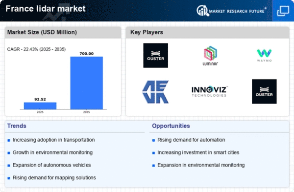
France LiDAR Market Size was estimated at 63.9 (USD Million) in 2023. The France LiDAR Market Industry is expected to grow from 75.6(USD Million) in 2024 to 451.6 (USD Million) by 2035. The France LiDAR Market CAGR (growth rate) is expected to be around 17.643% during the forecast period (2025 - 2035).


Key France LiDAR Market Trends Highlighted


The France LiDAR market is experiencing significant growth, driven by advancements in technology and increasing applications across various sectors. One of the key market drivers is the rising demand for precise geographical data, which has seen a surge in sectors like agriculture, forestry, and urban planning.


The French government has been actively promoting the use of LiDAR technology for environmental monitoring and urban development initiatives, aligning with its commitment to sustainable development. With infrastructure projects gaining momentum, especially in public transport and smart city initiatives, the need for detailed topographical data is becoming more pressing.


Recent trends also show a shift towards integrating LiDAR with other emerging technologies such as artificial intelligence and machine learning, enhancing data processing capabilities and analytical accuracy. This integration aids in urban planning and disaster management strategies, addressing climate change challenges that France is currently focusing on.


Moreover, the adoption of airborne LiDAR systems is growing, attributed to their efficiency in large-scale mapping and monitoring tasks, as seen in various government-led geological surveys and habitat mapping projects. Opportunities exist for local firms to develop specialized applications tailored to meet the specific needs of the French market.


Collaborations between technology providers and governmental bodies are expected to create a robust ecosystem, fostering innovation and expanding the application landscape for LiDAR in France. As the country aims to enhance its digital infrastructure and support sustainable practices, these opportunities can be significantly beneficial for stakeholders in the LiDAR space. The ongoing commitment of the French authorities to incorporate advanced technologies in environmental and urban management further cements LiDAR's role, indicating robust future trends within this market.


France Lidar Market size   


Source: Primary Research, Secondary Research, MRFR Database and Analyst Review


France LiDAR Market Drivers


Growing Demand for Environmental Monitoring


The increasing awareness regarding environmental issues in France is driving significant demand for LiDAR technology in environmental monitoring applications. Organizations such as the French National Institute for Geographic and Forest Information (IGN) are actively utilizing LiDAR technology to create highly detailed topographical maps and assess changes in land use.


With France's commitment to reducing greenhouse gas emissions by 40% by 2030, as stated in the French Climate Law, this has led to a surge in initiatives that require real-time data for various projects.


Reports from IGN indicate that approximately 90% of local municipalities have adopted some form of environmental monitoring tool, which is heavily reliant on advanced technologies such as LiDAR. This growing need for precise data reinforces the role of the France LiDAR Market Industry in supporting the government and enterprises in achieving environmental sustainability goals.


Advancements in Autonomous Vehicles


The autonomous vehicle sector in France is experiencing substantial growth, and LiDAR technology plays an essential role in this evolution. Companies like Valeo, a leading French automotive supplier, are investing heavily in utilizing LiDAR systems to enhance the safety and navigation capabilities of autonomous vehicles.


According to the Association for Automotive Innovation in France, the French automotive industry is projected to invest over USD 10 billion in Research and Development (R&D) of smart mobility solutions by 2025.


This rising investment indicates an increasing reliance on LiDAR for mapping environments in real-time, which is crucial for the development of self-driving cars. The advancements in vehicle technologies create a robust demand for LiDAR systems, thus contributing positively to the France LiDAR Market Industry.


Infrastructure Development Initiatives


France's ongoing infrastructure development initiatives are significantly bolstering the demand for LiDAR technology. The French government's plan to invest around EUR 24 billion in public transport projects and infrastructure over the next five years directly translates into an increased need for high-accuracy mapping solutions.


LiDAR technology is widely used in construction and infrastructure projects to ensure precise measurements and data collection for planning and execution.According to the French Ministry of Ecological Transition, about 60% of these projects require advanced mapping tools, out of which LiDAR holds a vital place due to its efficiency.


This alignment between government initiatives and the capabilities provided by the France LiDAR Market Industry enables better planning, execution, and maintenance of critical infrastructure.


France LiDAR Market Segment Insights


LiDAR Market Product Type Insights


The France LiDAR Market has shown significant segmentation based on Product Type, primarily encompassing Airborne LiDAR and Terrestrial LiDAR. Each of these product types plays a crucial role in various applications, thereby influencing the growth and direction of the market. Airborne LiDAR technology is predominantly used for large-scale mapping and data collection over extensive areas, leveraging aircraft to capture high-resolution data.


This method is especially significant in surveying applications, natural resource management, and environmental monitoring, providing a comprehensive view that is invaluable for urban planning and infrastructure development initiatives within France.On the other hand, Terrestrial LiDAR serves a critical function in capturing detailed, ground-level data for specific areas. This technology is predominantly used in construction, archaeology, and heritage conservation, where precision and detail are paramount.


The demand for high-resolution modeling and real-time data collection further enhances the importance of Terrestrial LiDAR, particularly in monitoring and assessing civil engineering projects. Both product types exhibit distinct advantages, appealing to different sectors, and reflect a broader trend towards advanced surveying techniques incorporating accuracy and efficiency.


The integration of LiDAR technology into various industries is propelled by the increasing need for precise data and robust analytical tools, which enhance decision-making processes for projects throughout France.


The ongoing investment in technological innovations supports the evolution of these segments, highlighting their relevance in the broader market dynamics and economic landscape. As urbanization continues to grow and environmental challenges increase, the reliance on both Airborne and Terrestrial LiDAR will remain instrumental in addressing these demands while fostering sustainable development in the region.


France Lidar Market Segment   


Source: Primary Research, Secondary Research, MRFR Database and Analyst Review


LiDAR Market Technology Insights


The France LiDAR Market, specifically within the Technology segment, showcases significant advancements and adept adaptations of LiDAR systems, driving the overall growth of the market. The segmentation into varying dimensional technologies1D, 2D, and 3Dserves different applications across multiple industries like agriculture, forestry, and urban planning.


The 1D technology is primarily utilized for distance measurement and is vital in simple terrain analysis, whereas 2D technology facilitates more detailed mapping by offering a planar view of the environment, crucial for mapping applications in urban settings.Meanwhile, 3D technology has emerged as a transformative element, providing extensive data capture and high-resolution imaging, making it particularly important in construction, architecture, and environmental monitoring.


This diversified technological landscape not only underscores the growing demand for precise geospatial data in France but also aligns with national initiatives to improve digital infrastructure and sustainability.


As companies incorporate more sophisticated LiDAR technologies, there is a noticeable shift towards integrated solutions that combine hardware and software, enabling real-time data processing and analysis, which is fundamental for efficient resource allocation and informed decision-making across various sectors.The evolving landscape of the France LiDAR Market reflects a clear trend towards innovation, creating ample opportunities for growth and development in the future.


LiDAR Market Component Insights


The Component segment of the France LiDAR Market is crucial, encompassing equipment such as Laser Scanners, Navigation and Positioning Systems, and various other components that play significant roles in LiDAR technology application. Laser Scanners are pivotal, offering high-resolution data capture for applications ranging from topographical mapping to urban planning.


Navigation and Positioning Systems enhance the accuracy of LiDAR data by ensuring precise geographic location during data acquisition, which is especially beneficial for autonomous vehicles and aerospace applications.


The overall demand for components in France is supported by the steady growth across industries engaged in Research and Development of advanced scanning solutions, with a focus on improving operational efficiency and data quality. Moreover, the integration of these components with emerging technologies like artificial intelligence and machine learning opens doors for innovative applications, driving further growth in the industry.


The complexity and functionality of these components reflect their significance in the broader LiDAR ecosystem, ensuring that France remains competitive in global markets reliant on precise measurement and mapping technologies.As the French government emphasizes the adoption of digital technologies, the potential for expanding applications of various components is ever-increasing, fostering market growth.


LiDAR Market Functional Areas Insights


The France LiDAR Market is witnessing significant growth within its Functional Areas segment, reflecting the diverse applications of LiDAR technology across various fields. Engineering utilizes LiDAR for precise measurements and 3D modeling, enhancing infrastructure projects and urban development. Corridor Mapping leverages this technology to efficiently survey transportation routes, which is crucial for France's extensive rail and road networks.


In the Environment realm, LiDAR plays a pivotal role in data collection for ecosystem monitoring and natural resource management, contributing to sustainable practices.The ADAS (Advanced Driver Assistance Systems) and Driverless Car segment is becoming increasingly significant, as LiDAR is essential for creating accurate spatial maps that enable safe navigation and obstacle detection. Urban Planning benefits from LiDAR's detailed topographical data, aiding city planners in making informed decisions.


Cartography also sees a transformation with LiDAR, providing highly detailed and accurate maps. Finally, Meteorology employs LiDAR technology for atmospheric studies, including cloud characterization and pollution tracking, which is crucial given France's focus on environmental issues.Overall, the multitude of applications signifies how the France LiDAR Market is adapting to technological advancements and rising demand across various sectors.


France LiDAR Market Key Players and Competitive Insights


The France LiDAR Market is experiencing significant growth and innovation, driven by advancements in technology and increasing applications across various sectors. The competitive landscape is characterized by a mix of established players and emerging startups, each vying for a larger share of the market through the introduction of cutting-edge solutions and services. The need for high-resolution mapping and surveying capabilities has intensified, particularly in industries such as infrastructure, forestry, and urban planning.


Companies in this market are focusing on enhancing the accuracy and efficiency of LiDAR systems while exploring new applications that leverage the technology's capabilities. As the demand for geospatial data continues to rise, understanding the competitive dynamics becomes essential for stakeholders looking to capitalize on opportunities in this evolving landscape.Quantum Spatial is a prominent entity in the France LiDAR Market, recognized for its strong emphasis on high-quality data acquisition and processing.


The company has established a solid market presence through its focus on delivering cost-effective and precise LiDAR solutions tailored to the needs of various sectors, including government agencies and private enterprises. Quantum Spatial's strengths lie in its comprehensive experience in mapping and geospatial data analysis, which allows it to provide customized solutions that cater to the unique requirements of different projects.


Their commitment to innovation is evident in their ongoing investment in advanced LiDAR technologies and techniques, ensuring that they remain at the forefront of the market and are able to offer top-tier services to their clientele in France.


Skify has carved out an important niche in the France LiDAR Market by emphasizing lightweight and accessible LiDAR solutions suitable for a range of applications, from conservation efforts to urban development projects. The company is known for its key offerings, which include portable LiDAR systems and advanced data processing software that enables users to gather and analyze spatial data quickly and efficiently.


Skify's market presence is bolstered by their strategic partnerships and collaborations with various stakeholders, enhancing their distribution networks across France. Notably, the company has engaged in mergers and acquisitions that have expanded its technological capabilities and market reach, allowing it to offer enhanced value to clients. This strategic focus, combined with a commitment to innovation and high-quality service delivery, reinforces Skify's position as a competitive player in the France LiDAR Market.


Key Companies in the France LiDAR Market Include


  • Quantum Spatial

  • Skify

  • Topcon

  • Trimble

  • Leica Geosystems

  • SenseFly

  • Microdrones

  • Drone Deploy

  • Airbus

  • Oceanscan

  • Riegl Laser Measurement Systems

  • Fugro

  • Hexagon AB

  • Teledyne Technologies

  • Pix4D


France LiDAR Market Industry Developments


Recent developments in the France LiDAR Market indicate a growing interest in this technology across various sectors, particularly in environmental monitoring and urban planning. Companies such as Quantum Spatial and Fugro have been expanding their services, focusing on integrating LiDAR with AI to enhance data accuracy and processing speed.


In July 2023, Skify launched a new LiDAR-enabled drone that significantly improves vegetation analysis, further increasing competition. The French government is also investing in geospatial technology, positioning France as a leader in LiDAR applications within Europe.


Additionally, the month of September 2023 saw Teledyne Technologies acquiring a French firm specializing in satellite imaging and LiDAR technologies, enhancing its capabilities in the European market. The merger attracted considerable attention, as it strengthens Teledyne's position amidst heightened competition from other players, such as Leica Geosystems and Trimble.


Growth in the market valuation of firms like Microdrones and Pix4D is driving innovation, with more applications emerging in sectors like agriculture and infrastructure development. The overall market is witnessing a significant shift due to these advancements and collaborative efforts among companies in France, promoting a vibrant and competitive landscape.


France LiDAR Market Segmentation Insights


LiDAR Market Product Type Outlook


  • Airborne LiDAR

  • Terrestrial LiDAR


LiDAR Market Technology Outlook


  • 1D

  • 2D

  • 3D


LiDAR Market Component Outlook


  • Laser Scanner

  • Navigation & Positioning Systems

  • Other Component


LiDAR Market Functional Areas Outlook


  • Engineering

  • Corridor Mapping

  • Environment

  • ADAS & Driverless Car

  • Urban Planning

  • Cartography

  • Meteorology

 
Report Attribute/Metric Source: Details
MARKET SIZE 2023 63.9(USD Million)
MARKET SIZE 2024 75.6(USD Million)
MARKET SIZE 2035 451.6(USD Million)
COMPOUND ANNUAL GROWTH RATE (CAGR) 17.643% (2025 - 2035)
REPORT COVERAGE Revenue Forecast, Competitive Landscape, Growth Factors, and Trends
BASE YEAR 2024
MARKET FORECAST PERIOD 2025 - 2035
HISTORICAL DATA 2019 - 2024
MARKET FORECAST UNITS USD Million
KEY COMPANIES PROFILED Quantum Spatial, Skify, Topcon, Trimble, Leica Geosystems, SenseFly, Microdrones, Drone Deploy, Airbus, Oceanscan, Riegl Laser Measurement Systems, Fugro, Hexagon AB, Teledyne Technologies, Pix4D
SEGMENTS COVERED Product Type, Technology, Component, Functional Areas
KEY MARKET OPPORTUNITIES Urban planning and infrastructure development, Environmental monitoring and management, Agriculture precision farming solutions, Construction and engineering advancements, Disaster management and risk assessment tools
KEY MARKET DYNAMICS Technological advancements in LiDAR, Increasing government investments, Growing demand in surveying, Expansion in autonomous vehicles, Adoption in agriculture and forestry
COUNTRIES COVERED France


Frequently Asked Questions (FAQ) :

The France LiDAR Market is expected to be valued at 75.6 million USD in 2024.

By 2035, the France LiDAR Market is projected to reach a valuation of 451.6 million USD.

The expected CAGR for the France LiDAR Market from 2025 to 2035 is 17.643 percent.

Airborne LiDAR holds the largest market share, valued at 40.0 million USD in 2024.

The anticipated market value for Airborne LiDAR by 2035 is 240.0 million USD.

Terrestrial LiDAR is valued at 35.6 million USD in 2024 and is expected to reach 211.6 million USD by 2035.

Key players include Quantum Spatial, Skify, Topcon, Trimble, Leica Geosystems, SenseFly, and Microdrones.

Key applications of LiDAR technology include mapping, surveying, forestry management, and urban planning.

Growth opportunities include advancements in technology, increased demand for high-precision measurements, and new applications in various sectors.

Current global trends, such as increased environmental awareness and urbanization, positively impact the growth of the France LiDAR Market.

Comments

Leading companies partner with us for data-driven Insights.

clients

Kindly complete the form below to receive a free sample of this Report

We do not share your information with anyone. However, we may send you emails based on your report interest from time to time. You may contact us at any time to opt-out.

Tailored for You
  • Dedicated Research on any specifics segment or region.
  • Focused Research on specific players in the market.
  • Custom Report based only on your requirements.
  • Flexibility to add or subtract any chapter in the study.
  • Historic data from 2014 and forecasts outlook till 2040.
  • Flexibility of providing data/insights in formats (PDF, PPT, Excel).
  • Provide cross segmentation in applicable scenario/markets.