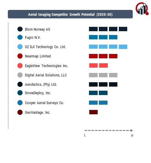
Top Industry Leaders in the Aerial Imaging Market

By transforming the way P&C insurers react to disasters, Nearmap, a top provider of location information and aerial photography solutions, hopes to relieve some of that burden. The company is launching an improved post-catastrophe response package that includes two new products, Nearmap ImpactTriage AI and Nearmap ImpactAssessment AI, together with the industry-leading Nearmap ImpactResponse post-catastrophe imaging. With the help of this innovative solution, insurers can repair damage and expedite the filing of claims by having access to a more comprehensive collection of AI-derived property insights in one location. Property and casualty (P&C) insurers are more conscious than ever of the growing impact that previous disasters, such as Hurricane Ian, have had on their operations as the natural disaster season of 2023 approaches.
Key Companies in the Aerial Imaging include
- Blom Norway AS (Norway)
- Fugro N.V. (Netherlands)
- SZ DJI Technology Co., Ltd. (China)
- Nearmap Limited (Australia)
- EagleView Technologies Inc. (US)
- Digital Aerial Solutions, LLC (US)
- Aerobotics, (Pty) Ltd. (South Africa)
- DroneDeploy, Inc. (US)
- Cooper Aerial Surveys Co. (US)
- GeoVantage, Inc. (US)
- Kucera International, Inc. (US)