Advancements in Data Analytics
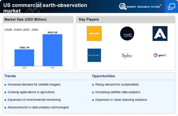
the commercial earth-observation-ceo market benefits from advancements in data analytics technologies. The ability to process and analyze vast amounts of satellite data has improved significantly, enabling more accurate insights and predictions. Companies are increasingly adopting big data analytics and machine learning techniques to extract valuable information from earth observation data. This trend is likely to enhance the market's appeal across various sectors, including agriculture, forestry, and disaster management. As analytics capabilities continue to evolve, the market may see a rise in demand for sophisticated data solutions, potentially increasing its overall value.
Climate Change Mitigation Efforts
the urgency of addressing climate change is propelling the commercial earth-observation-ceo market. Governments and organizations are increasingly leveraging satellite data to monitor environmental changes, assess natural disasters, and implement mitigation strategies. The market is projected to grow as stakeholders seek reliable data to inform policy decisions and climate action plans. Recent estimates suggest that climate-related applications constitute nearly 20% of the market. This trend indicates a growing recognition of the importance of earth observation in understanding and combating climate change, thereby enhancing the market's relevance.
Growing Applications in Agriculture
the commercial earth-observation-ceo market is experiencing a surge in demand due to applications in agriculture. Farmers and agribusinesses are increasingly utilizing satellite imagery to monitor crop health, optimize irrigation, and manage resources efficiently. This trend is driven by the need for precision agriculture, which can enhance yield and reduce costs. According to recent data, the agricultural sector accounts for approximately 30% of the total market share in the commercial earth-observation-ceo market. As technology advances, the integration of AI and machine learning with satellite data is expected to further enhance decision-making processes in farming, thereby propelling market growth.
Regulatory Support and Funding Initiatives
Regulatory support and funding initiatives from the US government are playing a pivotal role in the growth of the commercial earth-observation-ceo market. Various programs and grants are being introduced to promote the use of satellite data for public benefit, including environmental monitoring and disaster response. This support is likely to encourage private sector investment and innovation in earth observation technologies. Recent government reports indicate that funding for earth observation projects has increased by approximately 15% over the past year. Such initiatives are expected to bolster the market, making it more attractive for new entrants and established players alike.
Urban Planning and Infrastructure Development
Urbanization in the US is accelerating, leading to increased demand for effective urban planning and infrastructure development. the commercial earth-observation-ceo market provides crucial data for city planners and developers. Satellite imagery assists in land use planning, transportation management, and environmental impact assessments. Recent statistics indicate that urban planning applications represent around 25% of the market. As cities expand, the reliance on accurate and timely data from earth observation systems is likely to grow, fostering innovation and efficiency in urban development projects.


