India Remote Sensing Technology Market Overview
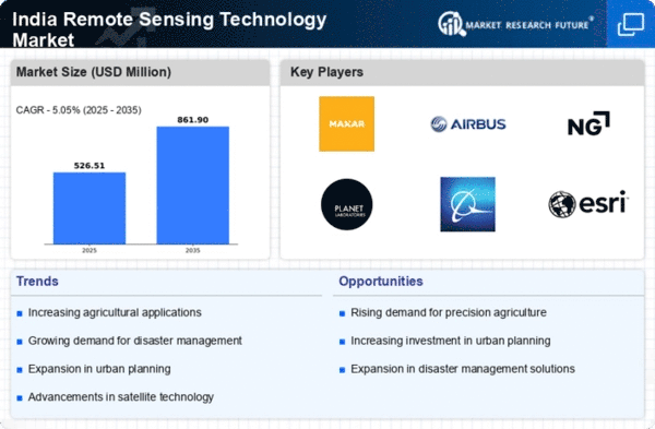
As per MRFR analysis, the India Remote Sensing Technology Market Size was estimated at 1.08 (USD Billion) in 2023.The India Remote Sensing Technology Market Industry is expected to grow from 1.18(USD Billion) in 2024 to 4.52 (USD Billion) by 2035. The India Remote Sensing Technology Market CAGR (growth rate) is expected to be around 13.001% during the forecast period (2025 - 2035)
Key India Remote Sensing Technology Market Trends Highlighted
The India Remote Sensing Technology Market is experiencing significant growth due to key market drivers such as increasing applications across various sectors like agriculture, urban planning, disaster management, and environmental monitoring. The Indian government has been promoting the use of remote sensing technology for effective land-use planning and resource management, driven by initiatives like the National Remote Sensing Policy. This support has led to higher adoption rates in both public and private sectors, fostering innovation and development in remote sensing applications.Â
Opportunities in the Indian remote sensing landscape are evolving rapidly, particularly as new technologies such as artificial intelligence and machine learning are integrated with traditional remote sensing methods.Companies are beginning to explore collaborations with agricultural and forestry sectors to enhance data analysis and visualization capabilities, which can improve decision-making processes. The challenge of connecting with underserved regions also presents pathways for companies to deploy low-cost satellite solutions, thereby creating demand for tailored services in remote areas.Â
In recent times, there has been a growing trend towards miniaturization of satellite technology, making it more accessible for local startups and research institutions in India. This democratization of technology is opening doors for innovative solutions that target specific local issues, such as air quality monitoring in urban areas or precise crop health analysis for farmers.Moreover, government initiatives aimed at fostering a robust space ecosystem, like the establishment of the Indian National Space Promotion and Authorization Center, are further enhancing the environment for remote sensing technology, showcasing a vibrant future for this sector within India.

Source: Primary Research, Secondary Research, MRFR Database and Analyst Review
India Remote Sensing Technology Market Drivers
Increasing Government Investment in Remote Sensing Infrastructure
One of the main factors propelling the India Remote Sensing Technology Market Industry is the government's growing emphasis on building out the country's remote sensing infrastructure. The launch of the GISAT satellite, which intends to improve weather forecasting and disaster management methods, is one example of how the Indian Space Research Organization (ISRO) has committed to improving satellite capabilities through the allocation of substantial monies in recent years.
This initiative is backed by national policies emphasizing the use of technology in monitoring environmental changes and agricultural practices. According to the Department of Space, in recent years, investments in space technology have been projected to grow by over 15 percent annually, thereby reinforcing the expected growth in the remote sensing sector as government policies increasingly integrate satellite data for various applications. The overall increase in government financing not only diversifies the applicability of remote sensing but also aims to promote sustainable practices in agriculture, forestry, and urban planning.
Increasing Demand for Agricultural Monitoring and Precision Farming
There has been a significant rise in the demand for advanced agricultural monitoring in India due to the need to enhance food security and optimize resource use. According to the Ministry of Agriculture and Farmers' Welfare, India's food grain production target is set at approximately 300 million metric tons by 2030, necessitating the need for precise data collection to manage resources efficiently. Remote sensing technology plays a crucial role in precision agriculture by providing real-time data on crop health, soil conditions, and weather patterns, thus enabling farmers to make informed decisions.
Market players such as KisanHub are leveraging satellite imagery and analytics to help farmers increase crop yields and drive sustainable farming practices. This surge in agricultural data application directly correlates to the anticipated growth of the India Remote Sensing Technology Market Industry.
Rising Climate Change Awareness and Environmental Monitoring
In recent years, India has witnessed an increasing recognition of climate change consequences and the urgent need for effective environmental monitoring. The Ministry of Environment, Forest and Climate Change has established frameworks encouraging the adoption of remote sensing solutions as critical tools to monitor environmental indicators and mitigate the impacts of climate change. Innovative applications that utilize remote sensing technology have been integral in tracking deforestation rates and urban sprawl, with reports indicating that the forest cover decreased by 0.22 percent between 2015 and 2017, according to official data.
Organizations like the National Remote Sensing Centre play a pivotal role in this regard, enabling policymakers and researchers to access vital data for assessing and managing environmental changes. This heightened focus on climate action is expected to significantly boost investments in the India Remote Sensing Technology Market Industry, as it becomes instrumental in supporting environmental protection initiatives.
Technological Advancements in Data Analytics and AI Integration
Rapid technological advancements in data analytics and artificial intelligence have greatly influenced the growth prospects for the India Remote Sensing Technology Market Industry. The increasing computational capabilities allow for the processing of complex satellite data at unprecedented speeds, thus enabling quicker and more accurate assessments across various sectors, including urban planning, agriculture, and disaster management. A statement from the Ministry of Electronics and Information Technology highlighted that the integration of AI with spatial data is expected to create value worth USD 11 billion in the Indian GIS industry by 2025.
Companies like Lincoln Electric and others are investing heavily in AI-driven analytics platforms that leverage remote sensing data to produce actionable insights for businesses and governments alike. The synergy between advanced analytics and remote sensing technology enhances existing applications and paves the way for innovative uses, reinforcing the importance of this trend in supporting the anticipated growth of the market.
India Remote Sensing Technology Market Segment Insights
Remote Sensing Technology Market Type Insights
The India Remote Sensing Technology Market showcases a significant division within the Type segment, primarily encapsulating active and passive remote sensing technologies, each serving distinct purposes and applications. Active remote sensing technology, which emits its own signals, plays a crucial role in applications such as environmental monitoring, disaster management, and agricultural assessments. This technology is particularly vital for acquiring real-time data, enabling timely interventions and informed decision-making in critical scenarios, such as flood or drought management, where rapid data acquisition can significantly minimize risks to life and property.
On the other hand, passive remote sensing technology relies on natural energy sources, primarily solar radiation, and is widely utilized for earth observation, climate studies, and resource management. Its ability to capture reflected light provides comprehensive data regarding Earth's surface and atmosphere, aiding in urban planning, forest monitoring, and natural resource exploration. The importance of these technologies is underscored by the fact that both active and passive modalities complement each other, enhancing capabilities in data collection and analysis.
The advent of advanced satellite systems and sensors has propelled the integration of these technologies into various sectors, including agriculture, forestry, water resource management, and urban development, creating extensive insights and fostering sustainable practices across India. Furthermore, the governmental push for digitization and smart city initiatives amplifies the relevance of cutting-edge remote sensing technologies, as they facilitate data-driven governance and infrastructure development. Amidst evolving market dynamics, the Type segment continues to witness robust growth, driven by the increasing demand for geospatial intelligence and actionable insights across multiple industries, leading to enhanced operational efficiencies and promoting sustainable growth in India's economy.
As the country aims to harness its diverse resources effectively, both active and passive remote sensing technologies are expected to play pivotal roles in navigating future challenges, thus highlighting their intrinsic value within the broader scope of India's remote sensing market.

Source: Primary Research, Secondary Research, MRFR Database and Analyst Review
Remote Sensing Technology Market Application Insights
The India Remote Sensing Technology Market has shown strong growth, driven by its diverse applications across various sectors. The agriculture sector significantly benefits from remote sensing technologies to enhance crop monitoring and yield prediction, which is crucial for India's primarily agrarian economy. In military applications, remote sensing aids in surveillance and reconnaissance, providing vital intelligence for national security. Disaster management utilizes these technologies to assess damage and coordinate response efforts effectively, helping mitigate the impacts of natural calamities prevalent in the region.
Infrastructure development, especially in urban planning, leverages remote sensing for efficient land use mapping and resource management, supporting India's rapid urbanization. Weather applications harness remote sensing data to improve forecasting models, which is essential in a country that experiences varied climatic conditions. Other emerging areas are witnessing gradual adoption of remote sensing, tapping into its potential for monitoring environmental changes and urban expansion. Overall, the segmentation showcases how the India Remote Sensing Technology Market is aligning with the country's socio-economic needs, with each application playing a vital role in addressing contemporary challenges.
Remote Sensing Technology Market Platform Insights
The Platform segment of the India Remote Sensing Technology Market plays a crucial role in advancing various applications across sectors. With the upcoming technological advancements, the demand for satellite and aerial systems is significantly growing, especially in industries like agriculture, urban planning, and disaster management. Satellites provide extensive coverage, enabling continuous monitoring of land use and environmental changes, which is crucial for effective resource management in a diverse country like India. Meanwhile, aerial systems offer high-resolution images and precise data over smaller areas, essential for detailed surveys and mapping tasks.
The combination of these platforms enhances capabilities in data collection, analysis, and implementation of various projects. As India continues to invest in Research and Development, both satellite and aerial systems are expected to gain more prominence, aligning with the government's goals of leveraging technology for socio-economic development. These platforms collectively contribute to improved decision-making processes and optimized resource allocation, demonstrating their importance in the overall landscape of the India Remote Sensing Technology Market.
India Remote Sensing Technology Market Key Players and Competitive Insights
The India Remote Sensing Technology Market is characterized by a variety of competitive players and a rapidly growing ecosystem that provides comprehensive solutions for agriculture, urban planning, disaster management, and environmental monitoring. The market has seen significant advancements due to government initiatives, increased investments in satellite technology, and rising demand for accurate data analytics across sectors. As various players strive to enhance their technological capabilities, the competitive landscape is continuously evolving. Companies in this sector leverage advanced tools, analytical methods, and satellite imagery to cater to a wide array of applications, positioning themselves for long-term growth in a dynamic economic environment.
RMSI stands out in the India Remote Sensing Technology Market due to its substantial expertise in geospatial data analytics and a strong portfolio of services. The company has established a robust presence through its focus on integrated solutions, catering to sectors such as smart cities, agriculture, and utilities. RMSI’s strengths lie in its proficient team of geospatial professionals and its commitment to delivering innovative solutions that meet specific client needs. The company is recognized for its high-quality data processing capabilities and has positioned itself as a thought leader in the remote sensing domain. By continuously evolving its technology offerings and expanding its operational reach, RMSI remains competitive in a market that is experiencing rapid growth and transformation.
The Indian Space Research Organisation plays a pivotal role in the India Remote Sensing Technology Market, specifically through its development and deployment of various satellite systems and services that provide critical data for numerous applications. ISRO’s remote sensing satellites, such as Landsat and Cartosat series, deliver high-resolution imagery vital for applications in agriculture, urban development, soil health management, and natural disaster assessment. The organization’s strengths lie in its advanced satellite technology and significant government support, which enables it to maintain a dominating position in the market. Additionally, ISRO strives for continuous innovation through collaborations and strategic partnerships with national and international entities. The organization has successfully executed numerous missions that enhance its capabilities, thereby solidifying its role as a leader in the remote sensing space within India. The combination of infrastructure, expertise, and commitment to research and development underscores ISRO’s influence in shaping India’s technological landscape in remote sensing.
Key Companies in the India Remote Sensing Technology Market Include
- RMSI
- Indian Space Research Organisation
- Geospatial World
- Satellite Applications Catapult
- MapmyIndia
- GetMap
- National Remote Sensing Centre
- Aerial Works
- Esri India Technologies
- Remote Sensing Solutions
- Emerging Technologies
- Antrix Corporation
- Wageningen University & Research
- OptiMap
- Pixxel
India Remote Sensing Technology Market Industry Developments
The India Remote Sensing Technology Market has recently seen significant developments, particularly through the initiatives of the Indian Space Research Organisation, which has been actively promoting satellite technology for various applications including agriculture, disaster management, and urban planning. Noteworthy collaborations include the involvement of companies such as RMSI and MapmyIndia, which are pushing the boundaries of geospatial applications in smart city projects. In terms of market valuations, entities like Geospatial World and Esri India Technologies have noted substantial growth, driven by increasing demand for precision in remote sensing data.Â
Notable happenings in the last few years include the launch of the GIS-based platform by the National Remote Sensing Centre in September 2022, aimed at enhancing data accessibility. As for mergers and acquisitions, in March 2023, Pixxel announced a strategic partnership with Antrix Corporation, enhancing its satellite data capabilities, further bolstered by support from Wageningen University and Research. This collaboration reflects an ongoing trend of innovation in the remote sensing field. The continued focus on environmental monitoring, smart agriculture, and urban resilience is reshaping the landscape of the India Remote Sensing Technology Market.
India Remote Sensing Technology Market Segmentation Insights
Remote Sensing Technology Market Type Outlook
Remote Sensing Technology Market Application Outlook
-
- agriculture
- military
- disaster management
- infrastructure
- weather
- others
Remote Sensing Technology Market Platform Outlook
Â
Report Attribute/Metric Source: |
Details |
MARKET SIZE 2023 |
1.08(USD Billion) |
MARKET SIZE 2024 |
1.18(USD Billion) |
MARKET SIZE 2035 |
4.52(USD Billion) |
COMPOUND ANNUAL GROWTH RATE (CAGR) |
13.001% (2025 - 2035) |
REPORT COVERAGE |
Revenue Forecast, Competitive Landscape, Growth Factors, and Trends |
BASE YEAR |
2024 |
MARKET FORECAST PERIOD |
2025 - 2035 |
HISTORICAL DATA |
2019 - 2024 |
MARKET FORECAST UNITS |
USD Billion |
KEY COMPANIES PROFILED |
RMSI, Indian Space Research Organisation, Geospatial World, Satellite Applications Catapult, MapmyIndia, GetMap, National Remote Sensing Centre, Aerial Works, Esri India Technologies, Remote Sensing Solutions, Emerging Technologies, Antrix Corporation, Wageningen University & Research, OptiMap, Pixxel |
SEGMENTS COVERED |
Type, Application, Platform |
KEY MARKET OPPORTUNITIES |
Agricultural monitoring innovations, Urban planning solutions, Disaster management applications, Environmental monitoring advancements, Smart city integration solutions |
KEY MARKET DYNAMICS |
Government initiatives and funding, Growing agricultural applications, Increasing environmental monitoring needs, Rise in satellite data usage, Advancements in sensor technologies |
COUNTRIES COVERED |
India |
Frequently Asked Questions (FAQ) :
The India Remote Sensing Technology Market is valued at 1.18 billion USD in 2024.
By 2035, the market is expected to reach 4.52 billion USD.
The projected CAGR for the market from 2025 to 2035 is 13.001%.
The active segment is valued at 0.55 billion USD in 2024 and is expected to grow significantly by 2035.
The passive segment is expected to reach 2.32 billion USD by 2035.
Key players include RMSI, Indian Space Research Organisation, and Esri India Technologies among others.
Applications include agriculture, forestry, land use mapping, and disaster management.
Challenges include regulatory hurdles and the need for advanced technology adaptation.
The competitive landscape is becoming increasingly dynamic with emerging players and technological advancements.
Opportunities include expanding applications in urban planning and environmental monitoring.