France Remote Sensing Technology Market Overview
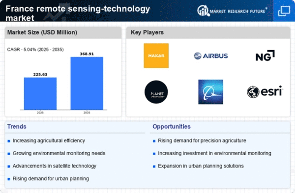
As per MRFR analysis, the France Remote Sensing Technology Market Size was estimated at 604.8 (USD Million) in 2023.The France Remote Sensing Technology Market Industry is expected to grow from 659.4(USD Million) in 2024 to 2,376 (USD Million) by 2035. The France Remote Sensing Technology Market CAGR (growth rate) is expected to be around 12.359% during the forecast period (2025 - 2035)
Key France Remote Sensing Technology Market Trends Highlighted
The France Remote Sensing Technology Market is seeing significant trends driven by the increasing demand for efficient environmental monitoring and resource management. With France's commitment to sustainable development, the government actively supports initiatives that utilize remote sensing technologies for agriculture, forestry, and urban planning. The development of advanced satellite systems and drone technology offers more accurate data collection, which is essential for addressing climate change challenges and enhancing disaster management strategies. This reflects a broader trend where industries, including agriculture, are adopting precision farming techniques to optimize crop yields and resource use.
Furthermore, opportunities exist in the emergence of small satellite technologies that ensure cost-effectiveness and accessibility of remote sensing data. French startups are increasingly collaborating with established companies to innovate and develop tailored solutions that cater to specific sectors such as transportation, energy, and land-use management. The growing demand for big data analytics in conjunction with remote sensing technologies presents an evolving opportunity to improve decision-making processes across various industries. Recent trends also indicate a rise in public and private investments in remote sensing capabilities, prompted by the French government's space strategy, which emphasizes the importance of satellite technology in maintaining national security and environmental protection.The integration of Artificial Intelligence with remote sensing is growing, facilitating better data processing and enhancing the understanding of complex environmental phenomena. Overall, the France Remote Sensing Technology Market is poised for development and growth, driven by technological advancements and an increasing emphasis on sustainability initiatives.

Source: Primary Research, Secondary Research, MRFR Database and Analyst Review
France Remote Sensing Technology Market Drivers
Increasing Demand for Environmental Monitoring
The expansion of the France Remote Sensing Technology Market Industry is being mostly driven by the country's increasing requirement for environmental monitoring and catastrophe management. The incidence of natural disasters, such as floods and wildfires, has risen by 30% in the past ten years, according to the French Ministry of Ecological Transition, underscoring the pressing need for sophisticated monitoring systems. Technologies for remote sensing help monitor changes in the environment and efficiently manage natural resources, resulting in prompt interventions.
Additionally, organizations such as CNES (Centre National d'tudes Spatiales) are actively involved in developing satellite-based remote sensing solutions, enhancing the capabilities for monitoring environmental changes. The integration of remote sensing technology allows for comprehensive data analysis, thereby supporting relevant policies aimed at environmental conservation and disaster readiness.
Growth in Agriculture and Precision Farming
The agricultural sector in France is increasingly embracing remote sensing technology for precision farming. The French Ministry of Agriculture reported a 15% increase in the use of precision agriculture tools from 2020 to 2022, driven by the need for enhancing productivity and sustainability. Remote sensing technologies help farmers to monitor crop health, optimize water usage, and increase yield efficiency.Â
By leveraging data from satellites and drones, agricultural stakeholders can make informed decisions regarding resource allocation.Organizations like INRAE (National Research Institute for Agriculture, Food, and Environment) are conducting extensive research that demonstrates the advantages of these technologies, further propelling their adoption in the agriculture sector.
Expansion of the Aerospace and Defense Sector
The aerospace and defense sector in France is significantly contributing to the growth of the France Remote Sensing Technology Market Industry. With defense budgets increasing annually, France's investment in satellite technology for military applications has surged by approximately 20% over the last five years, as reported by the French Ministry of Armed Forces. Remote sensing technologies are essential for reconnaissance and surveillance, subsequently driving the demand for advanced systems.
Prominent organizations such as Thales Group and Airbus Defence and Space are key players in this sector, developing innovative remote sensing solutions that enhance strategic capabilities. The continued focus on defense readiness is expected to further escalate the adoption of remote sensing technology.
France Remote Sensing Technology Market Segment Insights
Remote Sensing Technology Market Type Insights
The France Remote Sensing Technology Market showcases a diverse landscape, particularly evident within the Type segment, which is primarily divided into active and passive systems. Overall, remote sensing in France has seen significant advancements, providing critical advantages for various applications, including environmental monitoring, urban planning, and agricultural management. The active remote sensing systems utilize emitted signals to analyze the environment, allowing for greater precision in capturing data about terrain and surface conditions. This technology is instrumental in applications such as radar imaging, which plays a crucial role in agricultural assessments and flood monitoring, contributing positively to France's efforts in disaster management and natural resource management.
Conversely, passive remote sensing systems rely on naturally available energy, particularly solar radiation, to obtain information about the Earth's surface. Utilizing sensors that capture reflected sunlight, this technology greatly aids in vegetation studies, land-use planning, and climate monitoring, which are essential for sustainable urban development and ecological preservation in France. Furthermore, the integration of both active and passive systems enhances the breadth of France Remote Sensing Technology Market data available, offering rich insights that can influence policy-making and strategic planning at multiple governmental levels. The increasing dependency on remote sensing technology in France is largely driven by the growing need for precise, timely environmental data to support various industries, from agriculture to forestry and urban development.Â
However, challenges such as data acceptance, technology implementation, and cost management present substantial hurdles that need to be addressed in this dynamic industry. Overall, the evolution of these technologies not only reflects advancements in remote sensing capabilities but also highlights vital opportunities for future growth within the France Remote Sensing Technology Market segmentation landscape.

Source: Primary Research, Secondary Research, MRFR Database and Analyst Review
Remote Sensing Technology Market Application Insights
The France Remote Sensing Technology Market focuses on various applications that significantly contribute to different sectors, aligning with national priorities and strategic initiatives. Agriculture is increasingly utilizing remote sensing for precision farming, helping farmers monitor crop health and efficiently manage resources, thereby improving yield and sustainability. In military operations, remote sensing technology enhances surveillance and reconnaissance, making it indispensable for national security. Disaster management applications leverage this technology for early warning systems and damage assessment, thus playing a critical role in enhancing response efforts and reducing risks.
Infrastructure monitoring benefits from remote sensing by providing valuable data for urban planning and maintenance, contributing to smarter cities. Weather forecasting relies heavily on remote data for accurate predictions, which is essential for agriculture and disaster preparedness. Lastly, various other applications spanning environmental monitoring, resource management, and urban development showcase the versatility of remote sensing technology, reflecting its substantial impact and relevance across multiple sectors in France. The growing acknowledgment of these benefits is driving the market, indicating a promising trajectory for the overall industry.
Remote Sensing Technology Market Platform Insights
The France Remote Sensing Technology Market, particularly within the Platform segment, showcases significant diversity with applications spanning various industries such as agriculture, environmental monitoring, and urban planning. The demand for satellite-based systems is expanding rapidly due to their ability to provide extensive geographic coverage and high-resolution data crucial for effective decision-making. Aerial systems are also gaining traction, particularly in localized assessments and real-time monitoring, thanks to their flexibility and cost-effectiveness.
This dual approach to remote sensing technology allows for a comprehensive understanding and management of natural resources, making these platforms vital for addressing climate change and supporting sustainable development initiatives in France. Additionally, the integration of innovative technologies such as artificial intelligence and machine learning is boosting the efficiency and accuracy of data retrieval, further enhancing the overall market attractiveness. As organizations in France embrace these advancements, they position themselves to harness valuable insights that can drive economic growth and improve quality of life.
France Remote Sensing Technology Market Key Players and Competitive Insights
The France Remote Sensing Technology Market is witnessing dynamic growth driven by advancements in satellite technology, the increasing demand for precise environmental data, and the need for efficient resource management. This market encompasses a diverse array of applications, including agricultural monitoring, urban planning, disaster management, and climate research, attracting a wide range of stakeholders from government entities to private corporations. Competitive insights within this market reveal a landscape marked by both established players and emerging firms engaging in innovative practices to enhance their technological offerings and improve service delivery. The competitive environment is influenced by factors such as regulatory frameworks, funding opportunities, and technological advancements that facilitate collaborations aimed at bolstering market growth and addressing the changing demands for remote sensing solutions.
In the France Remote Sensing Technology Market, the company Thales is recognized for its strong presence and extensive capabilities in satellite-based solutions. The company boasts a robust portfolio of technologies that encompass reconnaissance, surveillance, and communication systems, integral to enhancing the efficacy of remote sensing applications. Thales is distinguished by its commitment to innovation and reliability, making it a key player in defense and civil sectors. The strength of Thales lies in its established relationships with governmental agencies and partnerships with research institutions, empowering the company to stay ahead in terms of technological advancements. Furthermore, Thales effectively leverages its engineering expertise and global network, thereby ensuring high-quality solutions tailored to meet the specific needs of the French market.
EOST plays a significant role in the France Remote Sensing Technology Market with its focus on Earth observation technologies and services. The company specializes in providing satellite imagery and geospatial data that cater to various sectors such as agriculture, forestry, and environmental monitoring. EOST has positioned itself as a leader in offering key products, including real-time satellite data processing and analysis tools that enable effective decision-making for its clients. The company's strength is further highlighted by its collaborative efforts with national and international research programs aimed at enhancing environmental understanding. Additionally, EOST's strategic moves in terms of mergers and acquisitions have bolstered its market share and expanded its service portfolio, allowing it to maintain a competitive edge in delivering advanced remote sensing solutions specifically designed for the unique challenges of the French market.
Key Companies in the France Remote Sensing Technology Market Include
- Thales
- EOST
- GeoIQ
- Capella Space
- Northrop Grumman
- ANALYSE
- Sodern
- Boeing
- Airbus
- CNES
- Spot Image
- Altamira Information
- TerraSARX
- ESA
- Planet Labs
France Remote Sensing Technology Market Industry Developments
Recent developments in the France Remote Sensing Technology Market indicate a robust growth trajectory, driven by advancements in satellite technology and data analytics. Companies like Airbus and Thales continue to innovate, with Airbus launching new Earth observation satellites designed to enhance real-time monitoring capabilities. In August 2023, Northrop Grumman announced a significant investment in analyzing environmental data through satellite networks, emphasizing the increasing focus on climate monitoring. Additionally, the partnership between CNES and EOST showcases a collaborative effort to enhance remote sensing applications in agriculture and urban planning.Â
Notably, market valuations for firms such as GeoIQ and Planet Labs have experienced significant increases, reflecting a greater demand for precise geospatial data. In September 2023, Spot Image was recognized for its contributions to the European Space Agency’s projects on sustainable development. In the merger and acquisition landscape, there were no significant updates reported in the recent months. However, trends suggest a continuously evolving market with an emphasis on public and private collaborations aimed at expanding the capabilities and applications of remote sensing technologies across various sectors in France.
France Remote Sensing Technology Market Segmentation Insights
Remote Sensing Technology Market Type Outlook
Remote Sensing Technology Market Application Outlook
-
- agriculture
- military
- disaster management
- infrastructure
- weather
- others
Remote Sensing Technology Market Platform Outlook
Â
Report Attribute/Metric Source: |
Details |
MARKET SIZE 2023 |
604.8(USD Million) |
MARKET SIZE 2024 |
659.4(USD Million) |
MARKET SIZE 2035 |
2376.0(USD Million) |
COMPOUND ANNUAL GROWTH RATE (CAGR) |
12.359% (2025 - 2035) |
REPORT COVERAGE |
Revenue Forecast, Competitive Landscape, Growth Factors, and Trends |
BASE YEAR |
2024 |
MARKET FORECAST PERIOD |
2025 - 2035 |
HISTORICAL DATA |
2019 - 2024 |
MARKET FORECAST UNITS |
USD Million |
KEY COMPANIES PROFILED |
Thales, EOST, GeoIQ, Capella Space, Northrop Grumman, ANALYSE, Sodern, Boeing, Airbus, CNES, Spot Image, Altamira Information, TerraSARX, ESA, Planet Labs |
SEGMENTS COVERED |
Type, Application, Platform |
KEY MARKET OPPORTUNITIES |
Satellite data analytics growth, Agriculture monitoring advancements, Smart city development initiatives, Climate change impact assessments, National security enhancements |
KEY MARKET DYNAMICS |
Growing demand for environmental monitoring, Advancements in satellite technology, Increasing defense and security applications, Integration with AI and big data, Government investments in space programs |
COUNTRIES COVERED |
France |
Frequently Asked Questions (FAQ) :
The France Remote Sensing Technology Market is expected to be valued at 659.4 million USD in 2024.
By 2035, the France Remote Sensing Technology Market is projected to reach a value of 2376.0 million USD.
The expected compound annual growth rate (CAGR) for the market is 12.359% during the period from 2025 to 2035.
Key players in the market include Thales, EOST, GeoIQ, Capella Space, Northrop Grumman, and many others.
The active remote sensing technology segment is valued at 329.4 million USD in 2024.
The passive remote sensing technology segment is expected to be valued at 330.0 million USD in 2024.
By 2035, the active remote sensing segment is projected to grow to 1168.0 million USD.
The passive remote sensing segment is expected to reach a market value of 1208.0 million USD by 2035.
Emerging trends include advancements in satellite technology and increased applications in agriculture, urban planning, and climate monitoring.
The current economic landscape is driving innovation and investment in remote sensing applications, enhancing market growth opportunities.