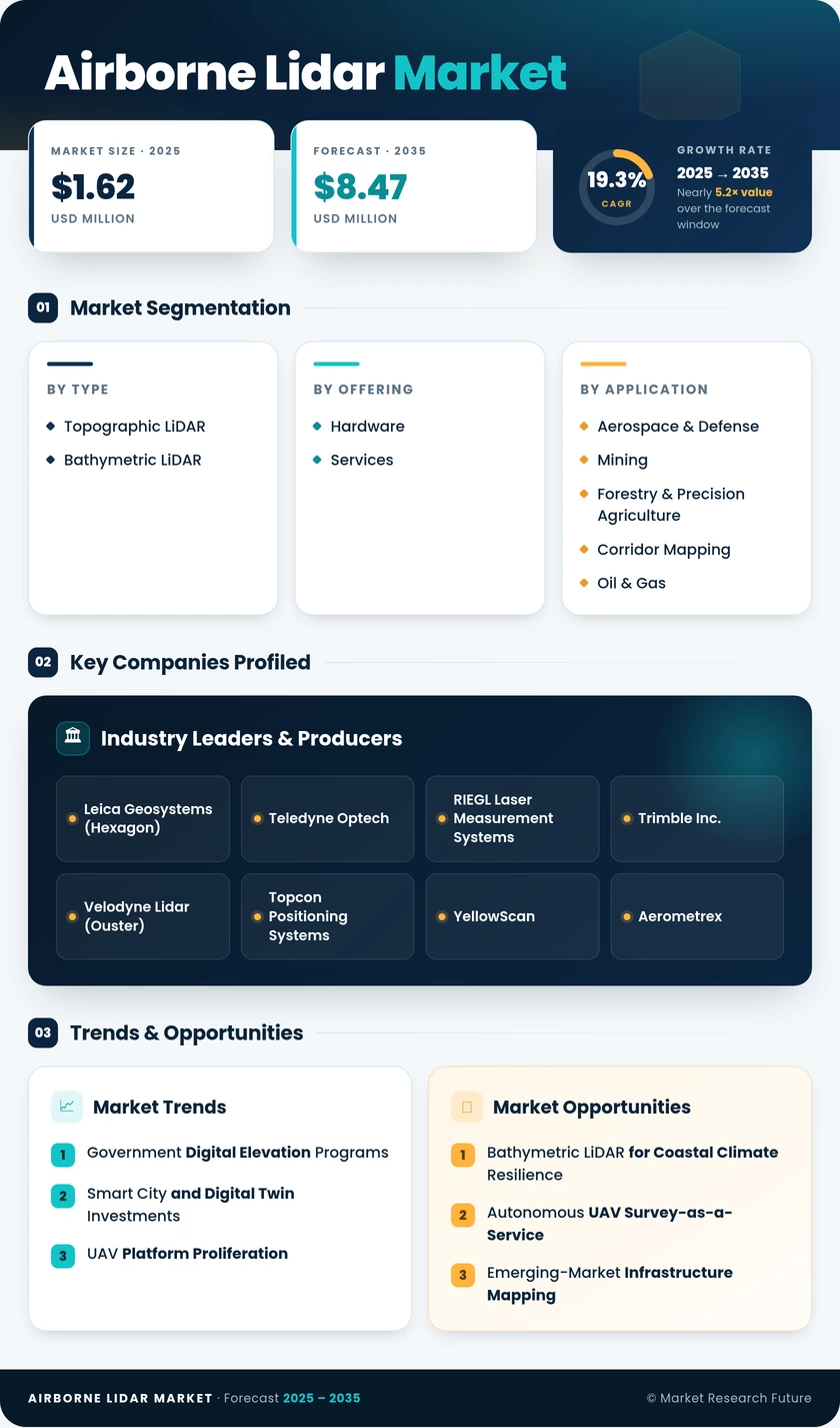
Segmentation Quick Reference
| Dimension | Sub-Segments | Dominant Segment | Fastest Growing Segment |
| By Type | Topographic LiDAR, Bathymetric LiDAR | Topographic LiDAR | Bathymetric LiDAR |
| By Offering | Hardware, Services | Hardware | Services |
| By End-User Vertical | Airborne LiDAR Market, Mining, Forestry & Precision Airborne LiDAR Market, Corridor Mapping, Oil & Gas | Airborne LiDAR Market | Mining |
| By Region | North America, Europe, Asia-Pacific, South America, Middle East & Africa | Asia-Pacific | North America |
Market Segmentation Overview
By Type
| Sub-Segment | Key Trend |
| Topographic LiDAR | Single-photon and Geiger-mode sensors enabling wide-area national mapping programs at reduced cost per km² |
| Bathymetric LiDAR | Green-wavelength laser integration expanding coastal and shallow-water surveying for climate adaptation |
Topographic LiDAR remains the backbone of the Airborne LiDAR Market, serving government elevation programs, defense terrain modeling, and smart-city digital twin construction. Bathymetric LiDAR is experiencing rapid adoption as coastal resilience mandates intensify and dual-wavelength sensor systems achieve seamless topo-bathy coverage in a single mission.
By Offering
| Sub-Segment | Key Trend |
| Hardware | Sensor miniaturization enabling sub-25 kg UAV integration; solid-state arrays replacing mechanical scanners |
| Services | Managed survey operations and cloud-based processing expanding through LiDAR-as-a-Service models |
Hardware continues to account for the majority of revenue, driven by fleet modernization and the transition to next-generation full-waveform sensors. Services are growing at a faster rate as end users across mining, forestry, and utilities increasingly outsource aerial LiDAR mapping survey operations to specialized providers.
By End-User Vertical
| Sub-Segment | Key Trend |
| Airborne LiDAR Market | ISR payload upgrades and terrain-following navigation database refresh cycles |
| Mining | Volumetric change detection and autonomous pit planning using high-density point clouds |
| Forestry & Precision Airborne LiDAR Market | Carbon accounting mandates and biomass estimation driving recurring resurvey demand |
| Corridor Mapping | Continuous monitoring replacing periodic campaigns for utilities and transport infrastructure |
| Oil & Gas | Pipeline routing, environmental baseline surveys, and regulatory compliance inspections |
Aerospace & defense leads end-user spending owing to persistent demand for geospatial intelligence and terrain modeling across NATO and Indo-Pacific defense programs. Forestry & precision agriculture is emerging as the fastest-growing application area, propelled by global carbon accounting frameworks and the expanding role of forestry LiDAR analysis in voluntary carbon markets.


 Noah Malgeri
Co-Founder
Noah Malgeri
Co-Founder

 Peter Groot koerkamp
Account and Business Manager
Peter Groot koerkamp
Account and Business Manager

 Younghwan Choi
Senior Retail Manager
Younghwan Choi
Senior Retail Manager

 Mark Irwin
Management Consultant
Mark Irwin
Management Consultant

 Akif Moroglu
Strategy & Business Development Director
Akif Moroglu
Strategy & Business Development Director

 Guilherme Gomes Martins
Product Management Director
Guilherme Gomes Martins
Product Management Director

 Joseph Aguayo
Sales Operations & Pricing Manager
Joseph Aguayo
Sales Operations & Pricing Manager

 La Terria Dodd
Program Support Specialist
La Terria Dodd
Program Support Specialist

 Rob Kooiker
Group Product Manager HVAC & Fire Protection GMA
Rob Kooiker
Group Product Manager HVAC & Fire Protection GMA