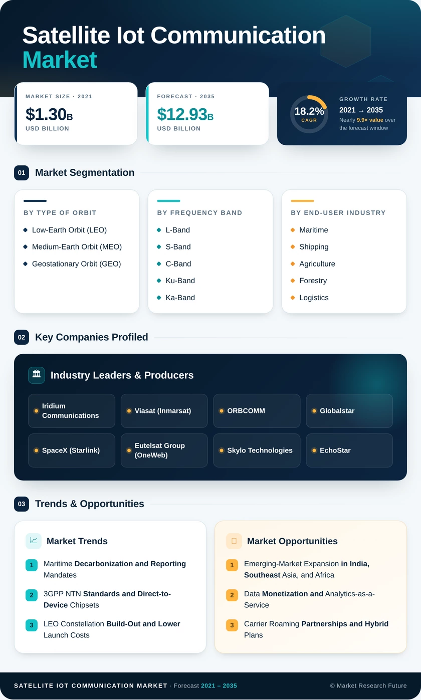
Segmentation Quick Reference
| Dimension | Sub-Segments | Dominant Segment | Fastest Growing Segment |
|---|
| By Type of Orbit | Low-Earth Orbit (LEO); Medium-Earth Orbit (MEO); Geostationary Orbit (GEO) | Low-Earth Orbit (LEO) (66.0% share) | Medium-Earth Orbit (MEO) (18.7% CAGR) |
| By Frequency Band | L-Band; S-Band; C-Band; Ku-Band; Ka-Band | L-Band (30.2% share) | Ka-Band (18.8% CAGR) |
| By End-user Industry | Maritime and Shipping; Agriculture and Forestry; Logistics and Intermodal Freight; Defense and Security; Environmental Monitoring; Other End-user Industries | Maritime and Shipping (36.5% share) | Environmental Monitoring (19.3% CAGR) |
| By Service Type | Satellite Asset Tracking; Remote Monitoring and Control; Direct-to-Device Connectivity; Backhaul Connectivity | Satellite Asset Tracking (43.4% share) | Direct-to-Device Connectivity (19.2% CAGR) |
| By Region | North America; South America; Europe; Asia Pacific; Middle East; Africa | North America (37.5% share) | Asia Pacific (21.1% CAGR (2026–2035)) |
Market Segmentation Overview
| Sub-Segment | Key Trend |
|---|
| Low-Earth Orbit (LEO) | Large constellations lower latency and terminal power needs |
| Medium-Earth Orbit (MEO) | Fewer satellites deliver continuous global coverage at lower capex |
| Geostationary Orbit (GEO) | Stable revenue from fixed sites and legacy maritime fleets |
Low-Earth Orbit (LEO) leads because short link distances let battery-powered sensors transmit with minimal energy, extending field life for years. Medium-Earth Orbit (MEO) grows fastest, since a constellation of eight to twenty satellites removes the pass gaps that complicate LEO service on polar shipping routes. Geostationary Orbit (GEO) holds its base through long-running fixed-site contracts.
| Sub-Segment | Key Trend |
|---|
| L-Band | All-weather, low-power links for maritime and agriculture |
| S-Band | Mobile-satellite spectrum supporting direct-to-device services |
| C-Band | Rain-resistant regional backhaul |
| Ku-Band | Maritime and enterprise terminal deployments |
| Ka-Band | High-throughput links for imagery and video |
L-Band remains the dominant band because it penetrates foliage and rain while keeping device power draw at milliwatt levels. Ka-Band grows fastest as environmental agencies stream multispectral and imaging data that lower bands cannot carry. S-Band gains share from direct-to-device services built on mobile-satellite spectrum.
| Sub-Segment | Key Trend |
|---|
| Maritime and Shipping | IMO-driven emissions and voyage reporting |
| Agriculture and Forestry | Soil sensing and EU deforestation traceability |
| Logistics and Intermodal Freight | Container and rail wagon visibility |
| Defense and Security | Encrypted border and logistics telemetry |
| Environmental Monitoring | Sensor-verified carbon and methane data |
| Other End-user Industries | Utilities, mining, and oil and gas sites |
Maritime and Shipping leads because IMO decarbonization rules require continuous fuel and route data from vessels far beyond cellular range. Environmental Monitoring grows fastest as carbon-credit issuance and methane rules depend on sensor-verified measurements. Agriculture and Forestry follows closely, pushed by EU geolocation requirements on imported commodities.
| Sub-Segment | Key Trend |
|---|
| Satellite Asset Tracking | Mature APIs integrated with fleet and warehouse software |
| Remote Monitoring and Control | Unmanned industrial and utility site oversight |
| Direct-to-Device Connectivity | 3GPP NTN support embedded in phones and modules |
| Backhaul Connectivity | Aggregated gateway traffic over one satellite link |
Satellite Asset Tracking dominates because established integrations with logistics software create high switching costs for enterprise buyers. Direct-to-Device Connectivity grows fastest as chipset makers build 3GPP NTN support into standard silicon, turning ordinary modules into satellite endpoints. Remote Monitoring and Control and Backhaul Connectivity support unmanned sites and remote gateways.


 Noah Malgeri
Co-Founder

 Peter Groot koerkamp
Account and Business Manager

 Younghwan Choi
Senior Retail Manager

 Mark Irwin
Management Consultant

 Akif Moroglu
Strategy & Business Development Director

 Guilherme Gomes Martins
Product Management Director

 Joseph Aguayo
Sales Operations & Pricing Manager

 La Terria Dodd
Program Support Specialist

 Rob Kooiker
Group Product Manager HVAC & Fire Protection GMA